FKT Report: Taconic Rim by Ben Nephew
Date: May 21st, 2017
Location: Mt Washington State Forest, Mt Everett Res & Taconic State Park NY
Adventure: South Taconic Trail & Appalachian Trail, 27 miles, 8,000 feet of gain
A little while ago I noticed a posting about a route called the Tri State U in MA, CT, and NY that covered about 28 miles, 8k of climb, and included the AT and the Southern Taconic Trail. I’m always interested in challenging new routes, and have been especially interested in new FKT routes in CT and MA that are accessible for months longer than trails up north. Dan Rosenthal and Ryan Williams have been working on a final route for the FKT, and after looking at the map, I decided to incorporate a few ideas from both for a potential FKT run. I choose to start at Catamount ski area, go south on the South Taconic Trail to CT, cut across to the AT, and head north to the Jug End road trailhead.
One of the biggest challenges of the day was getting to the start, as there was major traffic on the turnpike and rather slow drivers in front of me as I dropped a bottle at the southern end of the loop. I do find most drivers slow relative to my typical rate of progress, though. By the time I managed to find the start of the trail just east of Catamount ski area, it was almost 3pm. The current FKT was about 7 hours, so that would leave me finishing at 10pm. I was considering the option of an out and back scouting run, but took a headlamp in case I decided to keep going.
The first 1.5 miles consists of a steady climb mostly up a ski trail. The trail was somewhat overgrown, and you have to watch carefully for the left that returns to the woods towards the summit. There was some nice running over Mt. Fray and Prospect Hill, followed by a long gradual downhill. There had been some discussion about the Cedar Brook Trail being a more scenic option than the Taconic Trail heading down to route 344. I got the same impression from the map, and I think I chose wisely, as the Cedar Brook trail was some seriously fine running. A steep downhill section (50% grade) followed by runnable singletrack winding alongside Cedar Brook. The next mile long uphill became pretty serious at the top, with inclines up to 50%, and I started to realize that this route might be getting a bit more intense, where the first 6 miles were pretty mild.
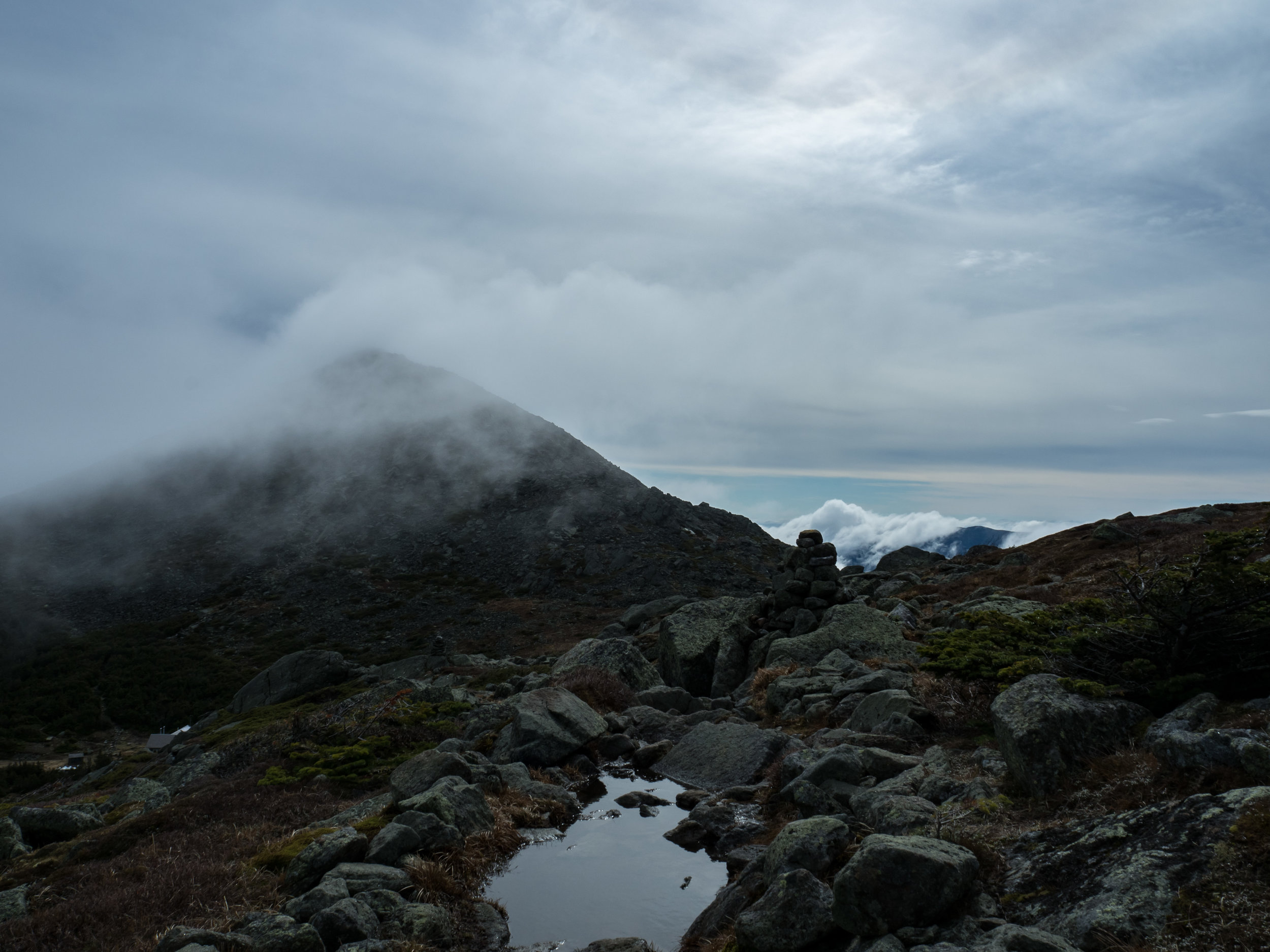
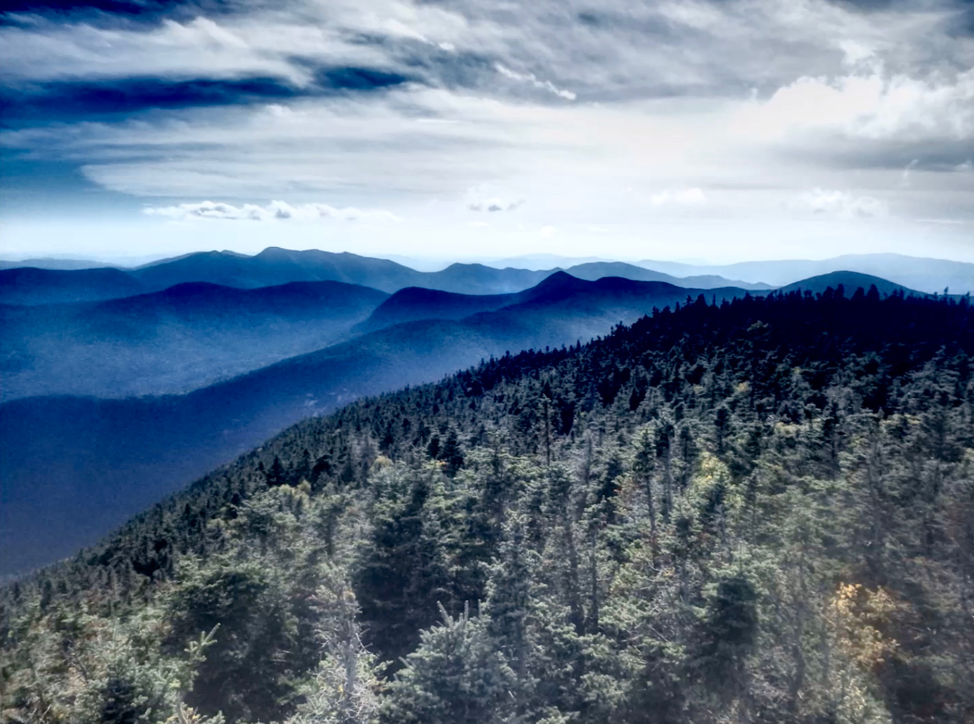
The following section over to Alander Mountain was again runnable, followed by another 50% downhill off the summit. I held back to save some quad for the second half, and the next 3 miles to Brace Mountain were gradual doubletrack. Even at this point, less than halfway, I had already experienced numerous sections of open ridge running with expansive views, usually off towards all my old friends in the Catskills. Considering the elevation, it is remarkable how much ridge running there is on the Taconic. While I had not run this section before, one thing that attracted me to the route was my experience on the Curly’s Trail Marathon course on the northern section of the Taconic ridge near Pittsfield. That course had some amazing ridge running, and it is too bad it was not continued.

The exclamation point to this western half of the rim was Mount Brace, which is a quick out and back from the main loop. Brace provides an amazing 360 degree view, and even I felt the need to stop to take it all in, which does not happen very often. The leisurely running stops with a short but steep ascent of Mt. Frissell, which has some full-on White Mountain style ledges when descending its east face, and there are a few more on the descent from neighboring Round Mountain. I was glad I had decided to wear my Oroc 280’s at this point. By the time I got to East St., I was over halfway into the run and picked up my bottle on my way to the AMC camp.
The camp gave me dejas vu of the White Mountain huts, with a fine looking cabin and no signs of the Bog trail that I really needed to find if I wanted to complete the actual FKT loop that goes up and over Bear Mountain. There is some outstanding signage leading to the outhouse, though. I was relieved to finally spot a blue marker from a distance through the trees. If you are at the south side of the cabin, the trailhead is about 100 meters southeast. After only a third of a mile, I emerged from a hedge onto Bear Mountain road and made my way to the AT, where I would spend the rest of my afternoon and early evening. The ascent of Bear was steady and moderate, where the descent was substantially steeper with a few sections where the grade was over 40%.
At this point, I was starting to get on familiar terrain, as we have friends that live in Salisbury CT and have spent time hiking and running on this section of the AT. Sage’s Ravine is an amazing piece of trail when legs are somewhat fresh, but it was a bit more challenging with over 3 hours of hard running behind me. The 1000’ ascent of Mt. Race is not incredibly steep, but cumulative fatigue meant that it required a substantial effort. The 1-2 punch of Race and Mt. Everett had me hurting by the summit, and I was relieved to start the last, mostly downhill, 4.5 miles to the end.
However, while it may be downhill, it is incessantly technical. There are sections where you can start to open it up, but they are limited and followed by ledges, series of hard turns, expansive and challenging off camber outcrops, or all of the above. The nice thing is that you have time to check out the picture perfect views to the east, and in my case, the sun setting through the trees to the west. This was highly motivating and my desire to not get out my headlamp made for an invigorating final descent to Jug End road which twists its way down the shattered side of the ridge. The run back to my car, which is 3.5 miles on the road, was not the most enjoyable experience and including that in the FKT would be considered a version of hell for most runners I know.

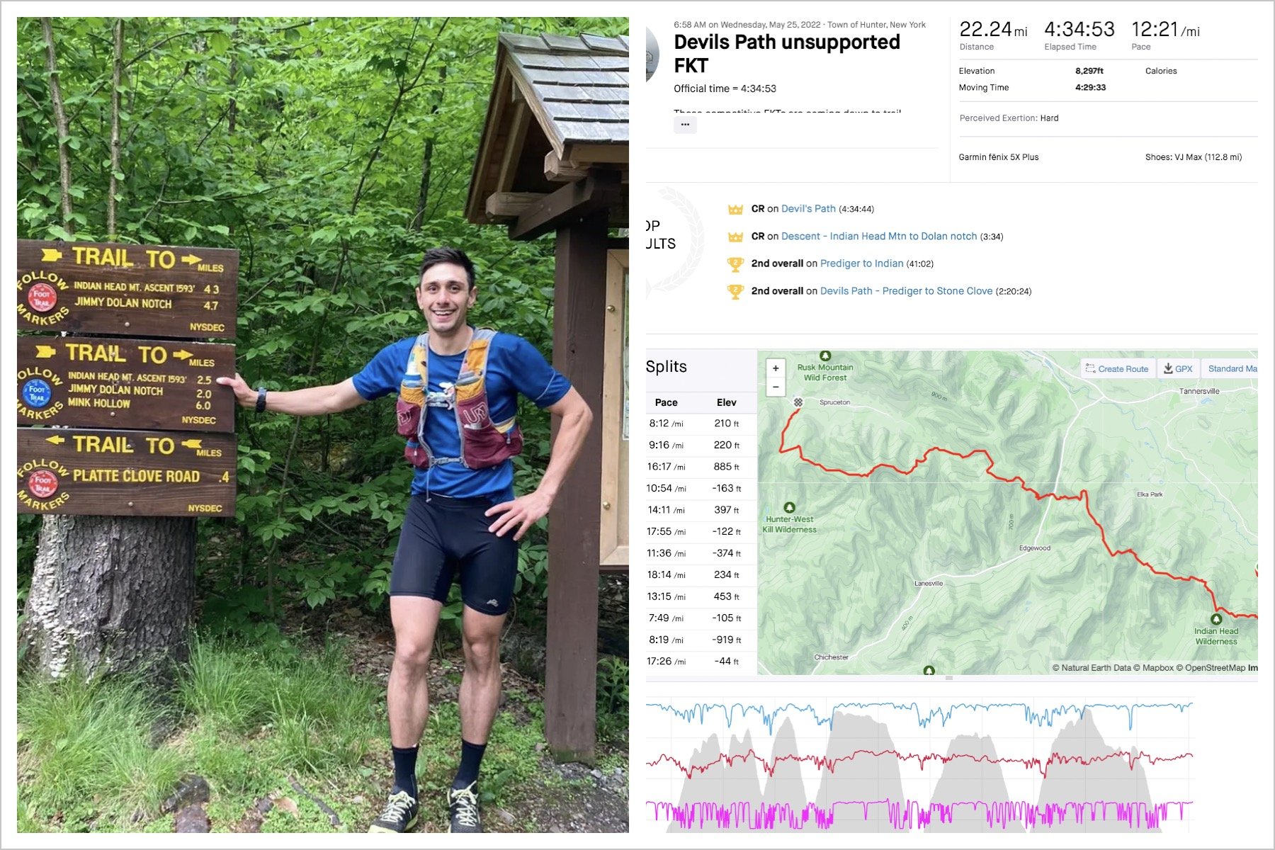
My final GPS values for the route are 27 miles and 7500’ of climb in 5:42:30, and the actual mileage is probably around 29 with 8500’ based on what my GPS calculates for other established routes. For the elevation, there are countless small changes in elevation that are likely to be missed in the GPS track. Those numbers are quite similar to the Pemi Loop. While the Pemi has more climbing, the Taconic Rim does not have 6.5 miles of carriage roads. The exposed ridges of the Pemi are actually more runnable as well. Similar to the Devil’s Path, the most challenging aspect of this route may be the cumulative impact of the technical terrain and steep descents. If you are looking for a challenging 25-30 mile mountain run, you don’t have to head all the way up to the White Mountains, and the Taconic Rim is free of snow for an additional 4 months!